
INCORPORATED 81 YEARS | 1945 -2026
The Town of Oliver, with its rich agricultural history and internationally recognized wineries, is located in the heart of the South Okanagan. Oliver is Canada’s Wine Capital.
Our Town offers:
- Arena, Facilities and an outdoor Pool
- Attractions and Tours
- Beach (Tuc-el-Nuit Lake)
- Parks and Amenities
- Wineries (Oliver/Osoyoos Winery Association)
Find out more at:
Learn more about Oliver!
- Image
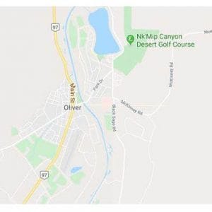
Oliver is situated in the south central area of British Columbia, Canada’s third largest province which occupies almost ten per cent of the country’s land surface. Oliver is located at 49° 12′ N, 119°32’W. The Town’s land area is approximately five square kilometers.
From the U.S.-Canadian border to Salmon Arm at the northern extreme, the Okanagan stretches over 200 km, yet averages only 15 km. wide for most of that distance. The South Okanagan area falls within the jurisdiction of the Regional District of Okanagan Similkameen, (RDOS), which includes the Town of Oliver and surrounding rural area.
The Columbia and Cascade mountain ranges in south-central B.C. surround the valley with elevations exceeding 2,100 m (7,000 feet) above sea level. The Okanagan’s landscape is made up of series of terraces and oblong lakes which were formed by glacial activity during the Tertiary and Pleistocene eras. The final retreat of the ice (between 11,000 and 9,000 years ago) left large deposits of gravel, silt, clay and sand on the bottom and sides of the valley floor.
It is estimated there are now over a quarter of a million people living in the Okanagan. The area has become a prime residential and small business relocation area due to the gentle climate, excellent transportation and the availability of world class recreational opportunities. The Okanagan offers business and investment opportunities in a location and environment which is second to none.
- Image

What is the One Hundred X One Hundred/x̌cəcikst X x̌cəcikst project?The year 2021 marks 100 years of the Oliver community, a community formed on and shaped by the ancestral, traditional, and unceded territory of the Syilx Okanagan Nation, whose history stretches back 10,000 years. In late 2020, a project entitled “One Hundred X One Hundred/x̌cəcikst X x̌cəcikst” was launched, and the providing an opportunity to explore our roots and share wisdom to build a stronger shared community, a deeper connection to the land, and to grow our future together for generations to follow.
Image
The Canada Mosaic Mural project was launched in 2015 to celebrate our 150th birthday, beginning the journey to complete 150 murals illustrating Canada’s cultural and geographical diversity.
The purpose of the project is to create a national mural including all provinces and territories, 100,000’s of paintings and 150 individual murals that when united will form one gigantic mural mosaic. The mural, if ever connected would be over 365 meters wide (4 football fields) x 2.5 meters high (8 feet).The mural will represent a cultural mosaic, a time capsule, a visual portrayal of history, an art masterpiece from the soul of the nation. An art piece that fifty years from now, may inspire another generation, who will in turn be able to celebrate through the mural, and maybe take it upon themselves to add to this memory.
Image
Oliver was granted its coat of arms and flag by the Chief Herald of Canada in 1994. They are a unique expression of the Town of Oliver’s natural and historic heritage.
Shield
This is centred on the central facets of Oliver’s geography and history. The green represents the land brought to life by the waters of the South Okanagan Irrigation Project, the wavy blue on gold symbolizing the great channel running across the gold of the dry lands. The sun represents the other essential ingredient in growth as well as a vital element in Oliver’s quality of life.
Image
The apple and horseshoe motif recalls one of the Town’s earlier emblems, honouring the first orchards and the horsepower which was central to early agriculture and transport. The miner’s pick and shovel recall the mining activities in the nearby hills that immediately preceded establishment of the present townsite.
Crest (above the shield)
Rising up out of the coronet, is the head of a Salish woman, in profile. She wears a special crown composed of a gold circle set with two eagle wings each coloured, diagonally, gold and red.
In Canadian municipal heraldry, while helmets and the cloth mantling protecting them are derived directly from the medieval knight’s helmet, the original support for the crest, they can symbolize the determination of citizens to safeguard the community and its resources.
The foundation element of the Oliver crest is the mural coronet, the traditional heraldic symbol for a municipality. Here it is made distinctive to Oliver by colouring the stones gold and setting a frieze of grape leaves around the centre of the crown.
The grape leaves symbolize the newest major product of the region and the continuing prosperity flowing from irrigation.
The head of the Salish woman has several meanings; it refers to the other name of McIntyre Bluff, and honours Oliver’s natural heritage, and the Salish First Peoples, and their Valley homeland. The red and gold eagle wings in her coronet are taken from a key element in the Scottish coat of arms for McIntyre and therefore honour Peter McIntyre, namesake of the Bluff and first orchardist near Oliver.
Compartment and Supporters
The Compartment on which the shield rests and the Supporters sand consists of a section of local fields as they would have appeared before irrigation, set with sage plants in natural colours. Below the fields are stylized wavy bands of blue and white representing the waters of the irrigation project.
On the left side is a California big horn sheep with a body in gold and horns and antlers of green. In heraldry, wherever it is possible, animals should be granted in pure heraldic colours, in this case drawn from the main colours of the shield. Around the sheep’s neck is a collar made of the Okanagan Tartan. On the right side is a gold mare with a mane and hooves of green wearing a similar collar.
The sheep symbolizes Oliver’s special natural setting with the mare honouring the early pioneers. The Okanagan tartan collars make them distinctive, in heraldry, to Oliver, and also refer to domestic arts and the ingenuity of citizens in terms of shaping the community.
Motto
“Borne of the Waters Blest by the Sun” is a motto combining a salute to Oliver’s beginnings and one of its greatest attractions, the sunny climate.
Flag
The field is blue. Across the horizontal centre line is a wavy band of gold. In the centre, on the band is a large gold circle and on it a smaller blue circle. In the centre of the blue circle is a sixteen rayed sun. The flag blends the imagery of the water with the sun and the central “O” for Oliver.
Image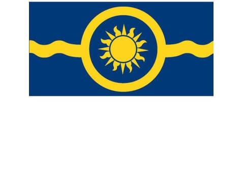
What do a one-armed gold miner, an honest politician, the world’s largest cherry pie and some of the best wines in the world have in common? Oliver, BC.
Aboriginal people occupied the territory, in which Oliver lies, from time immemorial when settlement by Europeans began in the 19th century. Osoyoos Indian Reserve No. 1 stretches from Gallagher Lake area to Osoyoos and adjoins the Town’s eastern boundary.
The Osoyoos Indian Band was established by the BC Government in 1877 as part of the Okanagan Nation which consists of 7 Member Bands on the North side of the US Border.
The first European activity in the area was gold mining, with the staking of the first claim in 1887, and the establishment of the Town of Fairview in 1890 on the benches above Oliver to the west. Folklore has it that a one armed gold prospector named Reid discovered gold in this area, and the Town of Fairview (located just outside what is now known as Oliver) became home to gold miners, ranchers and businessmen. Fairview was one of B.C.’s largest towns at the turn of the century. The gold rush died and sadly, so did Fairview, with Oliver springing up in its wake.
Fairview’s life was short; the post office was closed in 1926. One of the few remaining buildings from the town, the Fairview Jail, has been moved to the Oliver museum site.
Image
Following the First World War, BC’s premier, known as “Honest” John Oliver, envisioned an irrigation canal, which would bring this dry Sonora Desert region to life. The South Okanagan Lands Project was born, creating jobs and long term opportunities for veterans returning from World War I. The original townsite of Oliver was surveyed in 1921. Completed in 1923, the concrete irrigation canal (locally known as “the ditch”) soon transformed this desert region into lush orchards and farms. The airport, built just prior to the Second World War, initially served the entire region south of Penticton.
Oliver, along with Osoyoos to the south, experienced rapid growth after the Second World War, with an influx of agricultural settlers, including many of Portuguese and German origin.
Home to 11 local wineries and many vineyards, Oliver now calls itself “The Capital of Wine Country”. The Festival of the Grape is fast becoming a ‘must attend’ during the Okanagan’s Fall Wine Festival.
A thumbnail history of Oliver is presented below.
1812 – 1849 Fur Brigade Trail: 300 animal pack train transports furs from Kamloops area to Fort Okanogan at the junction of Okanagan River and Columbia River in Southern Washington. Fur Brigade Trail passes through what was to become Oliver. 1869 One-armed Reed and partner Ryan pan for gold in the mountain creeks on the west side of the South Okanagan Valley. Some gold is found but Reed and Ryan move on. 1887 Prospectors stake gold mining claims in the mountains on both sides of the South Okanagan Valley above what was to become Oliver. 1888 Small mining towns start to form; Camp McKinney on the east side of the valley and Fairview on the west side. 1890 – 1902 Mining activity expands in both areas with Fairview being the more active of the two. Fairview’s population grows to near 600 – Camp McKinney’s to near 250. 1897 A large three story hotel, The Fairview Hotel, (called the Big Teepee by natives in the area) is built in Fairview. It was reputed to be the largest and most well appointed hotel in the interior of BC. 1902-1906 Fairview Hotel burns down, gold in Fairview area and Camp McKinney starts to peter out. Both town sites start to diminish in size. 1902-1917 Minimum amount of mining activity keeps both mining communities barely alive. 1918 Provincial Government purchases 22,000 acres of land in the South Okanagan and proceeds to develop an irrigation system designed to convert some 8,000 acres of desert land, on each side of the Okanagan river, into viable agricultural land and make the land available, at a reasonable cost, to the returning soldiers from World War I. The Premier of the Province at the time was “Honest John Oliver”. Hence, the origin of the name of the Town of Oliver. 1918-1925 Construction of the Irrigation System known as the “Ditch” takes place. The overall length of the Ditch was some 25 miles including a large 7 foot diameter wood stave siphon, almost three quarters of a mile in length that transported irrigation water from one side of the valley to the other. 1919 The village of Oliver is beginning to be established with some of the home and business buildings being constructed from lumber salvaged from the fast disappearing Town of Fairview. 1926-1936 Population of Oliver grown from 500 to 1,800. Many orchards are planted and ground crops in the form of tobacco, tomatoes and cantaloupes and helping bolster the economy. Oliver becomes known as the Cantaloupe Capital of Canada. 1936-1946 Large Sawmill, including a box plant, develops in Oliver area providing major employment for the community. A number of fruit packing houses and canneries are operating and BC Fruit Processors, the forerunner to The SunRype Corp., was formed. 1945 Oliver is incorporated into a village. 1948 Large high school (existing South Okanagan Secondary School) is constructed in Oliver. 1949-1958 Okanagan River from Okanagan Falls to Osoyoos is reconfigured into a canal with dams and drop structures to facilitate lake level and flood control during spring run-off periods. 1960-1970 Ted Trump establishes plant in Oliver to develop and manufacture articulated hydraulic equipment to facilitate fruit picking and tree pruning. “The Girette” and other locally developed and manufactured “Kangaroo” has revolutionized the Orchard Industry. 1960's Major influx of Portuguese immigrants to the Valley, soon to become established as orchardists. 1971 Large RV manufacturer purchases Trump facilities and is still established as a major employer in Oliver. 1979-1990 Oliver grows in size and attracts retirees due to the quiet life style and good weather. Wine Grape Vineyards start to materialize. 1992 Major vineyards are planted and a number of associate wineries are developed. Oliver area boasts 9 local wineries. 1996 Oliver celebrates its 75th anniversary as a community. 2016 The population inside Oliver is close to 4,800. Agriculture is the main industry in the area now. The “Ditch” is still supplying irrigation water to the farms, orchard and vineyards in the valley. Oliver continues to be one of ‘the’ places to retire in Canada. With the recent drop in the Canadian dollar, ‘snowbirds’ from northern BC and other western provinces are making the Oliver area their winter destination. Today The population inside Oliver is 5094 based on the 2021 census. The Town will now take on the cost of RCMP. The cultural profile of the community includes members of the Osoyoos Indian Band, Portuguese, East Indian, German, Russian, Chinese and persons who have relocated here from all parts of Canada. Oliver and its businesses also serve a surrounding rural area of some 4,500 people bringing the total community population to around 9,600. Craig Baird the creator of Canadian History Ehx has released a Podcast on the history of The Town of Oliver. Please listen and take a trip down memory lane.
Audio file- Image
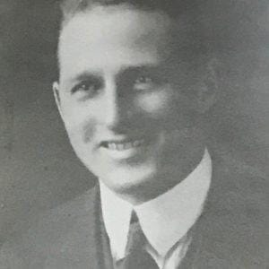
Robert W. Smith
1945Image
William H Laird
1946 -1953Image
Charles Harvey
1953Image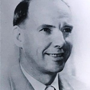
Larry E Evans
1954 -1956Image
William A Crana
1956 - 1957Image
T Harry Carter
1958-1965Image
Richard J Topping
1966 - 1973 and 1982 - 1986Image
Monica L Hoover
1974 - 1975Image
Leo McKinnon
1976 - 1979Image
W Wally Brogan
1980Image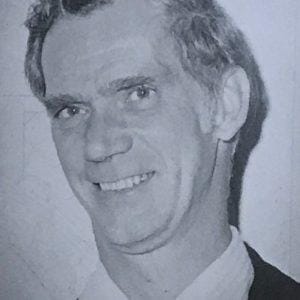
Ken Petty
1981Image
Harmut Buckendahl
1987 - 1993Image
Rick Wilson
1993 - 1996Image
Hal Carter
1996 - 1997Image
Linda Larson
1997 - 2005Image
Ron Hovanes
2005 - 2008
2011 - 2018Image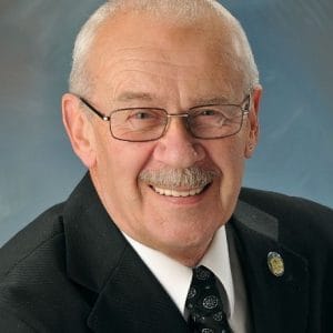
Pat Hampson
2008 - 2011Image
Mayor Johansen
2018 - current The Town of Oliver’s population was 5094 in 2021 (Statistics Canada), with an additional 3,986 people living in the surrounding rural areas (Electoral Area “C”).
Oliver’s saw a 3.4% of population growth. This compares to the provincial average of 7.6% and the national average of 5.2%.
From 2021 Census:
The age and gender distribution of the population for the Town of Oliver is approximately 48% male, while 52% of the population is female, the same as the region. 50% of the population is between 15 and 64 years of age, the region is higher at 56%.
In 2021, Town of Oliver has a median age of approximately 58 and the region is 56 years of age. The percentage of the population over the age of 65 is nearly 42%, within the region the population over 65 years of age is 37.2%.
The average income for a household in Oliver is $83,400, the median is $$68,500. Within the region the average household income is $89,100 and the median is $71,000, slightly higher than the Town of Oliver.
Image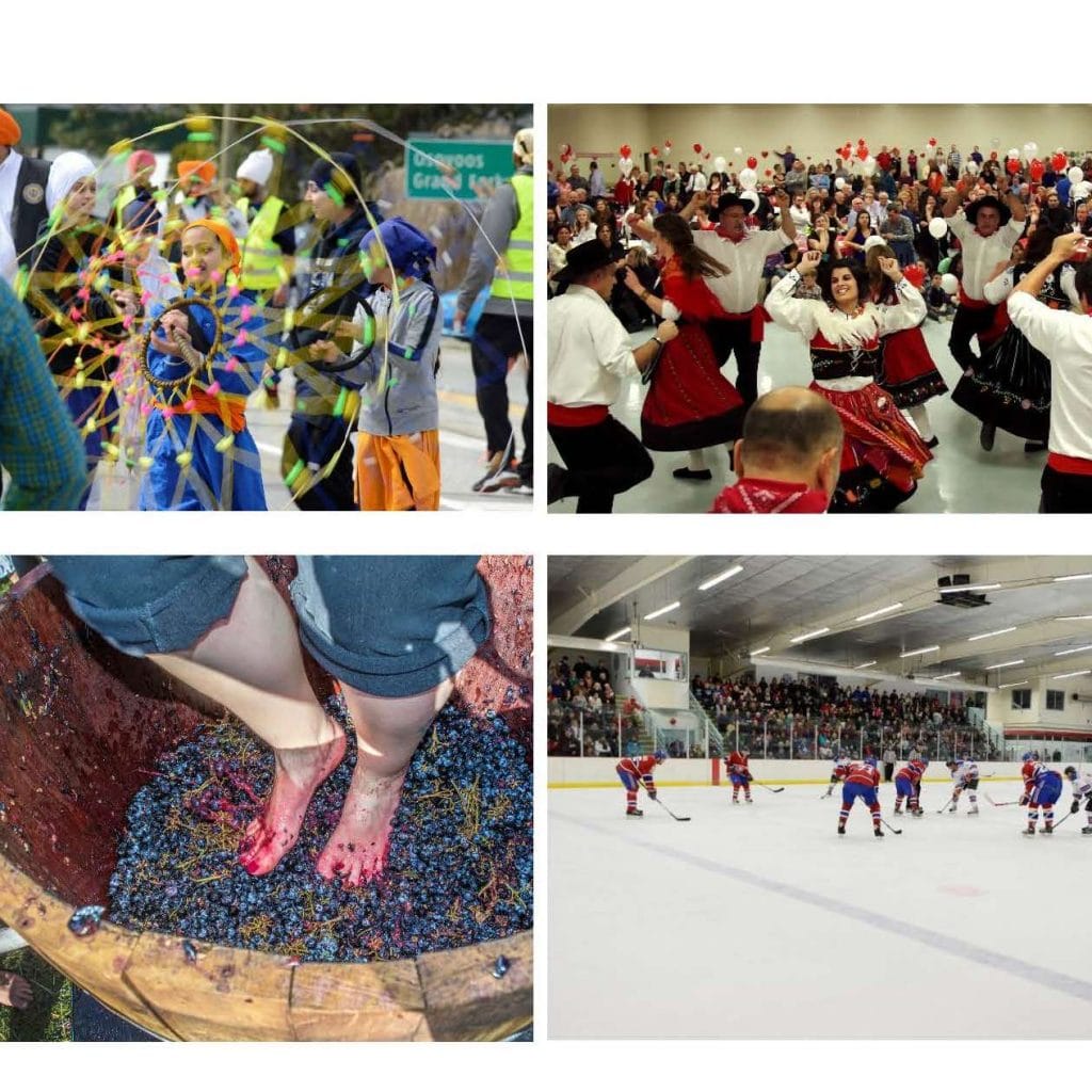
- Image

